ISRO Scientist Dr. Prakash Chauhan Delivers Insightful Lecture on GeoAI at TMU
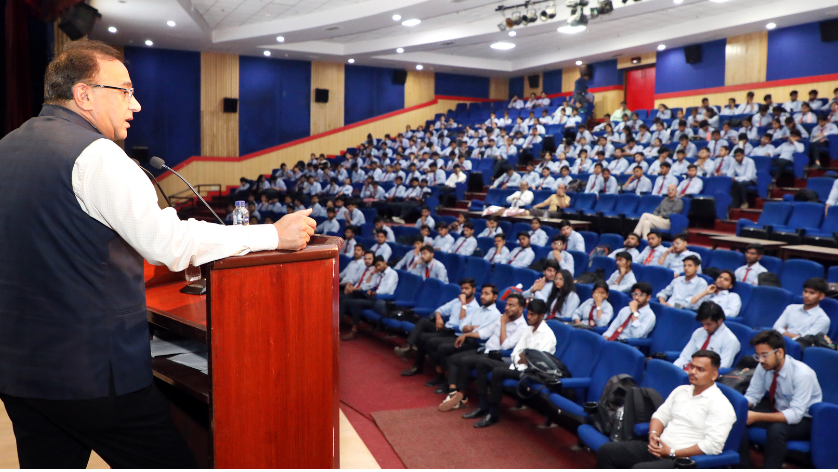
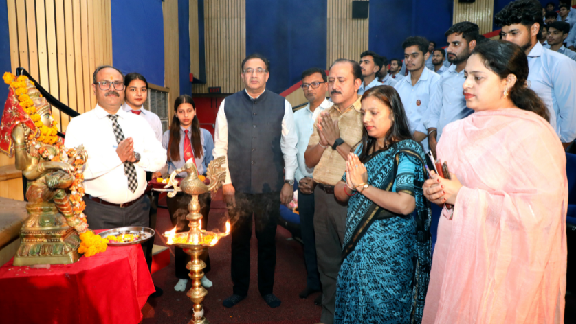
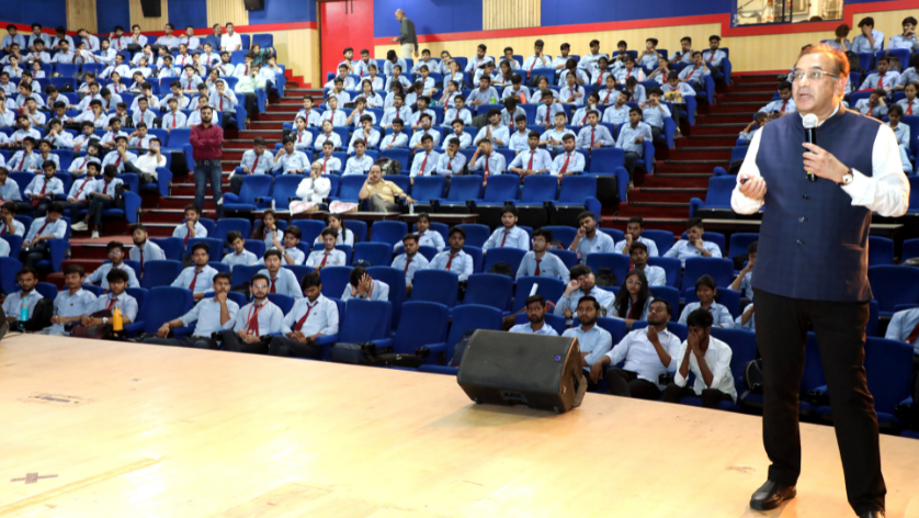
The Faculty of Engineering at Teerthanker Mahaveer University (TMU) hosted a distinguished guest lecture on GeoAI (Geospatial Artificial Intelligence). The lecture was delivered by Dr. Prakash Chauhan, Director of ISRO-NRSC, Hyderabad, and focused on the theme “GeoAI for Satellite Image Analytics.”
Bridging AI and Space Technology for Tomorrow’s Engineers
During the lecture, Dr. Chauhan introduced students to the cutting-edge integration of artificial intelligence in geospatial data processing. He elaborated on modern digital image processing techniques, remote sensing applications, and the pivotal role of AI in satellite data analysis.
Key areas discussed included:
- The use of AI in disaster management and environmental monitoring
- Urban planning and spatial data modelling using satellite imagery
- Career prospects and the growing demand for GeoAI professionals
- Emerging research and innovations in remote sensing and AI convergence
Inspiring Future Innovators in GeoAI
Dr. Chauhan emphasised that GeoAI is transforming traditional geospatial analysis, enabling faster and more accurate decision-making in sectors such as agriculture, urban development, and climate science. He encouraged students to explore research-driven careers in this rapidly evolving domain.
An interactive Q&A session followed the lecture, where students engaged enthusiastically and sought deeper clarity on the subject matter.
Collaborative Organisation and Student Participation
The event was successfully organised with the support of Prof. (Dr.) R.K. Dwivedi, Dean of Engineering, and Dr. Gulista Khan. TMU BCA students Ashish and Pratyaksha hosted the session with confidence and professionalism.
The lecture concluded with a heartfelt vote of thanks to Dr. Chauhan, along with appreciation to TMU’s leadership for continually facilitating such high-value academic interactions.